Ordnance Survey partners with Scottish Mountain Rescue to support volunteers
Ordnance Survey partners with Scottish Mountain Rescue to support volunteers
Ordnance Survey (OS) is equipping Scottish Mountain Rescue (SMR) volunteers with free access to the OS Maps App, providing advanced mapping tools to support their lifesaving missions.
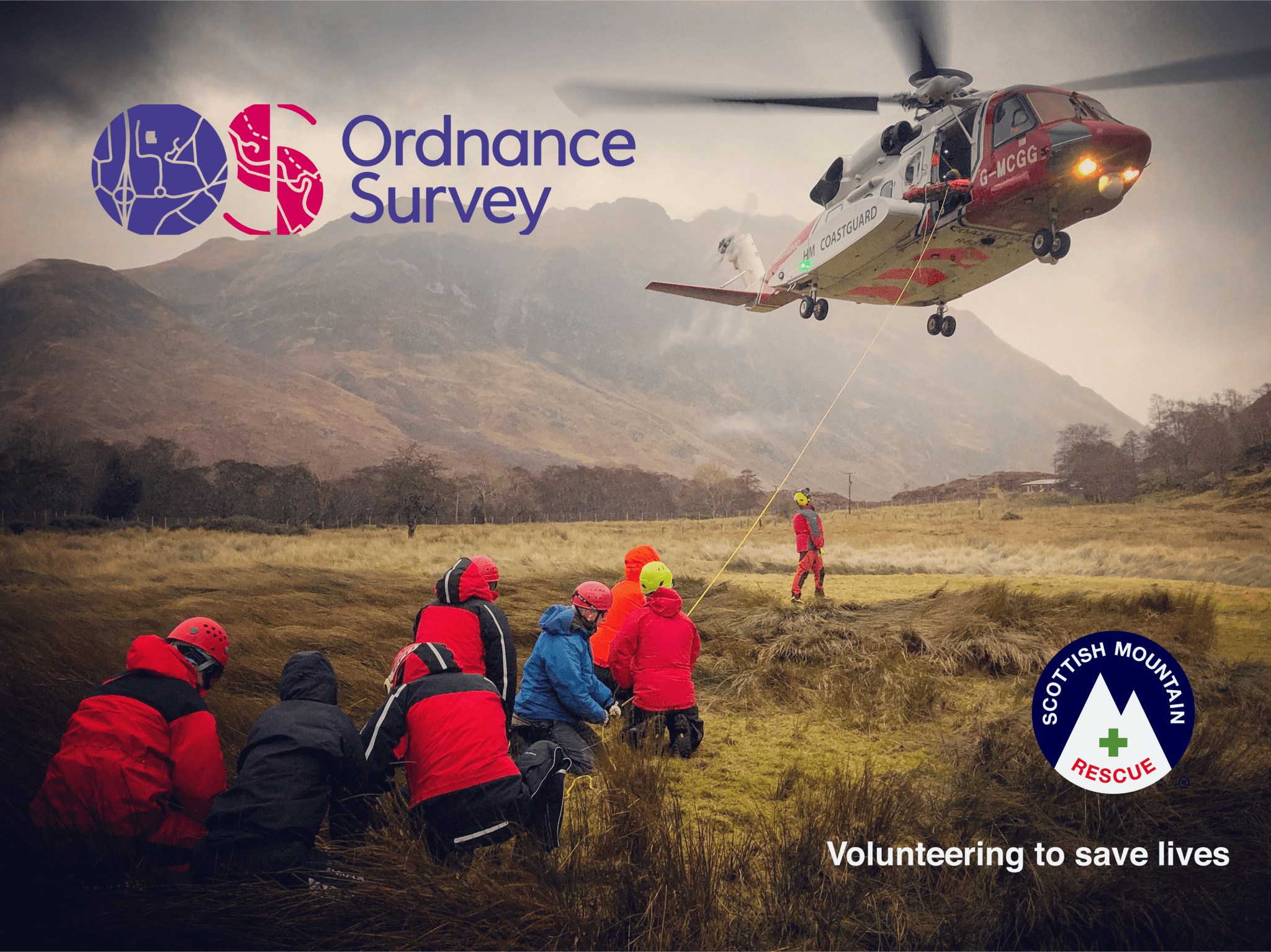
The 850 volunteers across Scottish Mountain Rescue’s 26 teams dedicate their time and expertise to responding to emergencies in Scotland’s most remote and challenging landscapes. With callouts at record levels, this partnership will provide powerful navigation tools to help them reach those in need.
Our mountain rescue volunteers give so much to help others, and we’re delighted to be able to support them in their vital work with this fantastic offering from OS. With premium access to OS Maps, they will have an invaluable tool for rescue callouts, training, and personal exploration. We’re very grateful to OS for supporting our teams with this initiative.
Scottish Mountain Rescue Chair, Bill Glennie says: “We are excited for Scottish Mountain Rescue and Ordnance Survey to be working together in a new partnership, bringing our organisations together with the shared aim of making our mountains and wild spaces a safer place for all to visit.
Increasing numbers of people are accessing the outdoors in Scotland, many of whom are exploring it for the first time. We are happy to see so many people enjoying our beautiful mountains and discovering all the mental and physical health benefits of time in our outdoors.
However, we are also aware that this has resulted in more people getting into difficulty and significantly increased call-outs for our member teams. Our rescues wouldn’t be possible without the dedicated volunteers in our rescue teams and the kindness of the mountain loving community that support us. We would like to say thank you and welcome Ordnance Survey in joining our life saving team. Together we can provide peace of mind for everyone who wants to enjoy the beautiful Scottish outdoors.”
Oban Mountain Rescue Team member Renate highlights the app’s value: “I can quickly search by grid reference to pinpoint casualties, which is crucial during a rescue.”
The OS Maps App offers a suite of navigation tools, including 3D terrain mapping, offline route downloads, and custom map printing. Tweed Valley Mountain Rescue Team member Tom adds: “I love being able to plan a route, export the GPX file, and have it on my watch in under a minute. It’s a great backup to my nav in the mountains and hills.”
OS will also use feedback from Mountain Rescue volunteers to refine and improve the app, benefiting everyone who explores Scotland’s great outdoors.
Our checklist for safe mountain adventures
· Build up your navigation skills and confidence with shorter, smaller days before taking on bigger hills and longer days. The OS Map App has over 1 million routes to select from!
· Check the mountain weather forecast – pay particular attention to wind speed, temperature and cloud cover.
· Take warm layers, waterproof clothing, hat, gloves and boots with good grip, group shelter, a head torch and spare, map and compass, first aid kit, plus crampons and ice axe for winter.
· Pack plenty of food and drink to keep you going, plus some extra just in case.
· Be prepared to turn back if the weather or conditions change.
· Let someone know where you are going, what time you will be back and what to do if you don’t return when expected.
· If you are injured or lost and can’t get off the hill call 999 and ask for POLICE then Mountain Rescue.
For more information visit the Ordnance Survey website and the Scottish Mountain Rescue Website.
Scottish Mountain Rescue is a registered Scottish Charity – no SC045003 More information can be found on our website www.scottishmountainrescue.org.